


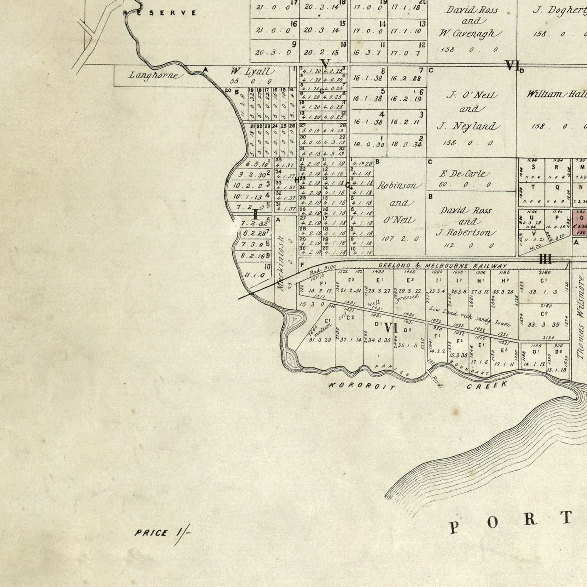

Parish of Cut Paw Paw, County of Bourke 1865
A very old and beautifully textured map from the Department of Lands & Survey dated 1865. Showing Parish of Cut Paw Paw, Yarraville, Williamstown, Footscray, Braybrook, and Maribyrnong land divisions. This also includes the block size and the name of the owner.
In 1840, Robert Hoddle (Yes, that street “Hoddle”) and his assistants surveyed the area and created the first accurate maps. The government then used these maps to divide the land into parishes and sections. The 1840s map was also the very first documented reference to the name Parish of Cut Paw Paw.
Some of the land owner names are still known today - notably Charles Spottiswoode (Now Spotswood), Thomas Chirnside (Queensville Estate which became Kingsville), and E. Blackshaw (Blackshaws Road), James Gill which was the central part of Yarraville. You’ll also note that most street names are derived from these surnames.
“Parish of Cut Paw Paw!" What the hell is that I hear you say? Well, long story, but it’s due to poor translation. The original Aboriginal name for this land was Koort boork boork. So a near enough guess of Cut Paw Paw was perceived. But, it actually meant “Clumps of many She-Oaks” which were the only prevalent shade-giving tree species on the inner west. Parish of She Oaks would have been much better.
We love this print because you can feel the early pioneering spirit coming from these first land subdivisions as you explore. Who wouldn’t love to own an entire suburb?
There is four variants of this Cut Paw Paw map available in the store. This one, the 1865 to 1952 version, the first 1840 version and Sheet 3 which is an isolated section around Footscray Yarraville area. View all Cut Paw Paw maps