


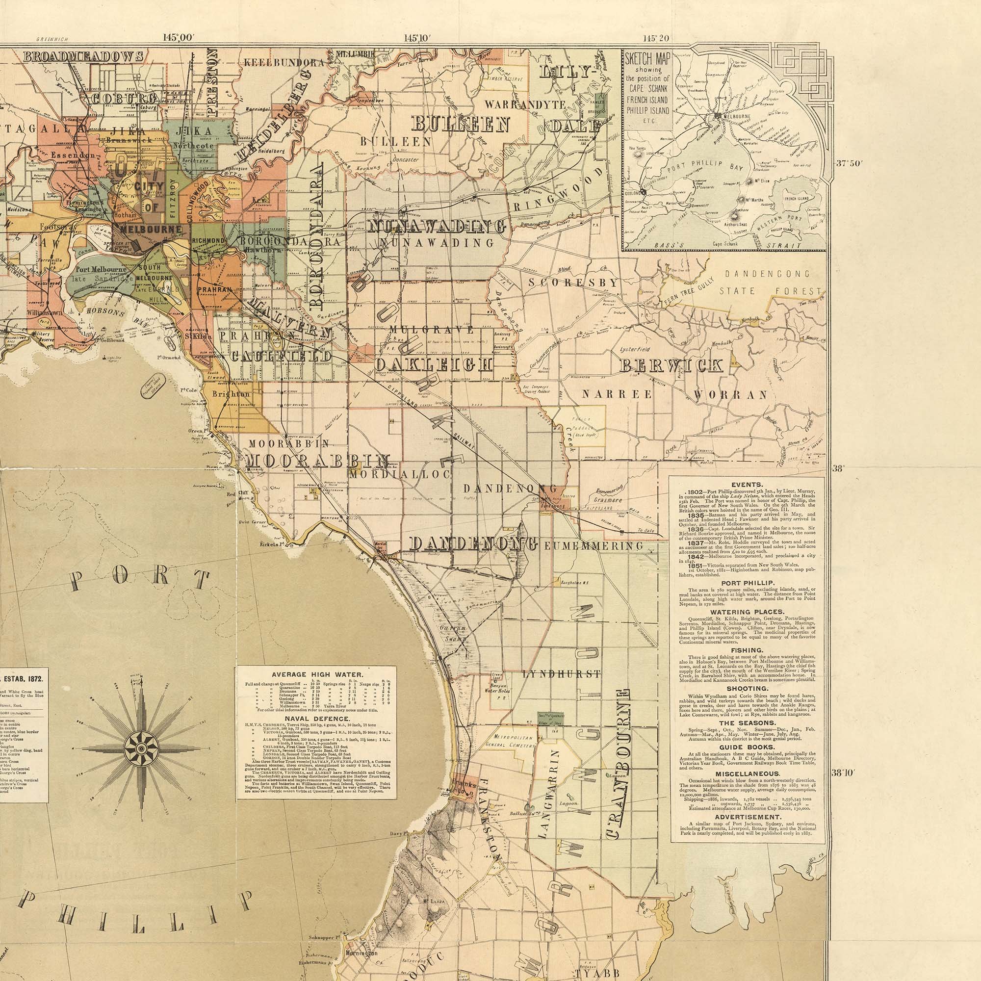

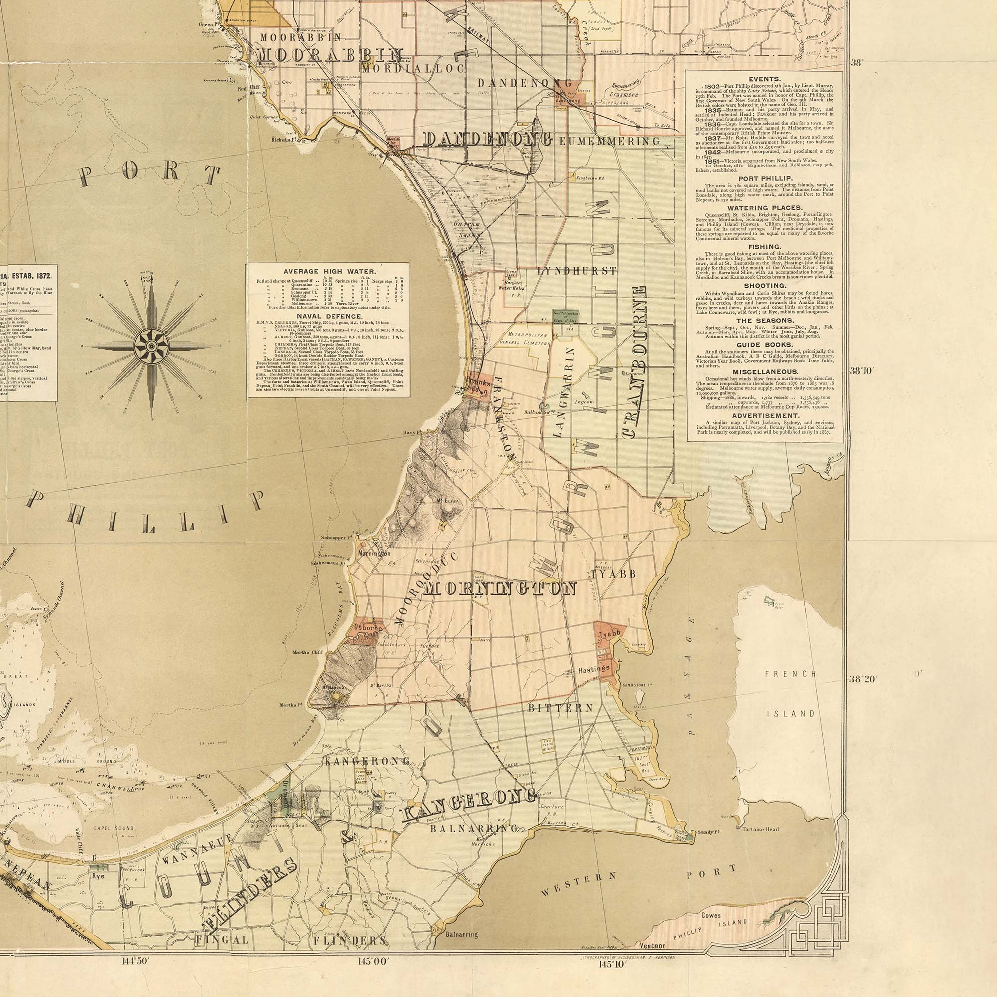
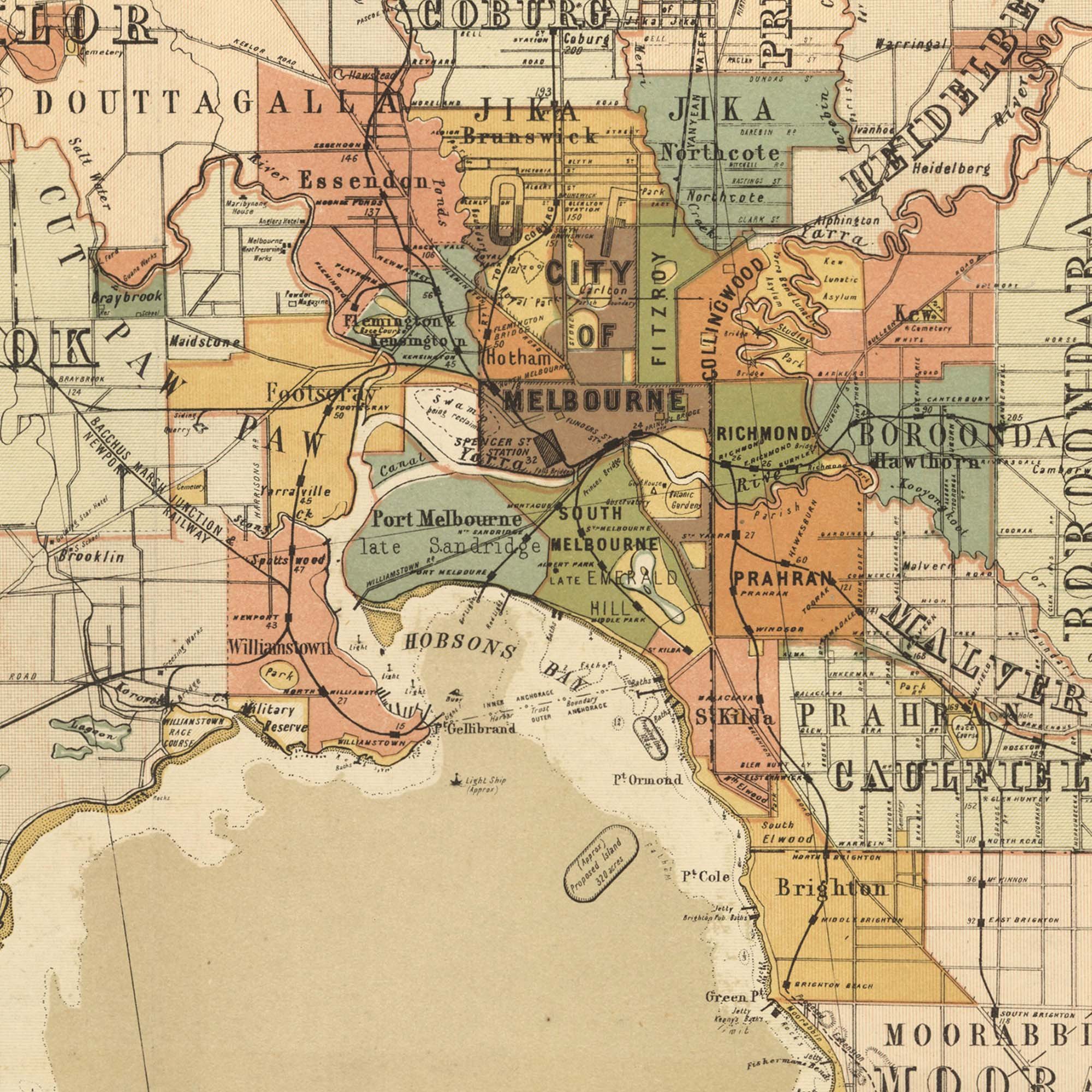
Yachting and Excursion Map of Port Phillip Melbourne 1886
This beautifully crafted map of Melbourne isn't just a visual delight—it's the perfect gift for any nautical enthusiast or avid lover of boats and yachting. With its charming 1880s color scheme and detailed portrayal of Port Phillip's maritime beauty. This poster encapsulates the city's nautical heritage in an elegant and captivating way. Whether for a seasoned sailor or someone with a passion for maritime history, this map is a cherished addition to any collection, combining nostalgic allure with a love for all things nautical.
Contains a map of Melbourne and Port Phillip Bay, showing boundaries, roads, railways, major buildings, tables of population statistics for cities, towns, boroughs and shires, Royal Yacht Club of Victoria (est. 1872), Victorian yachts, average high water and naval defences, events and things to do and places of interest for tourists.