Cart
undefined


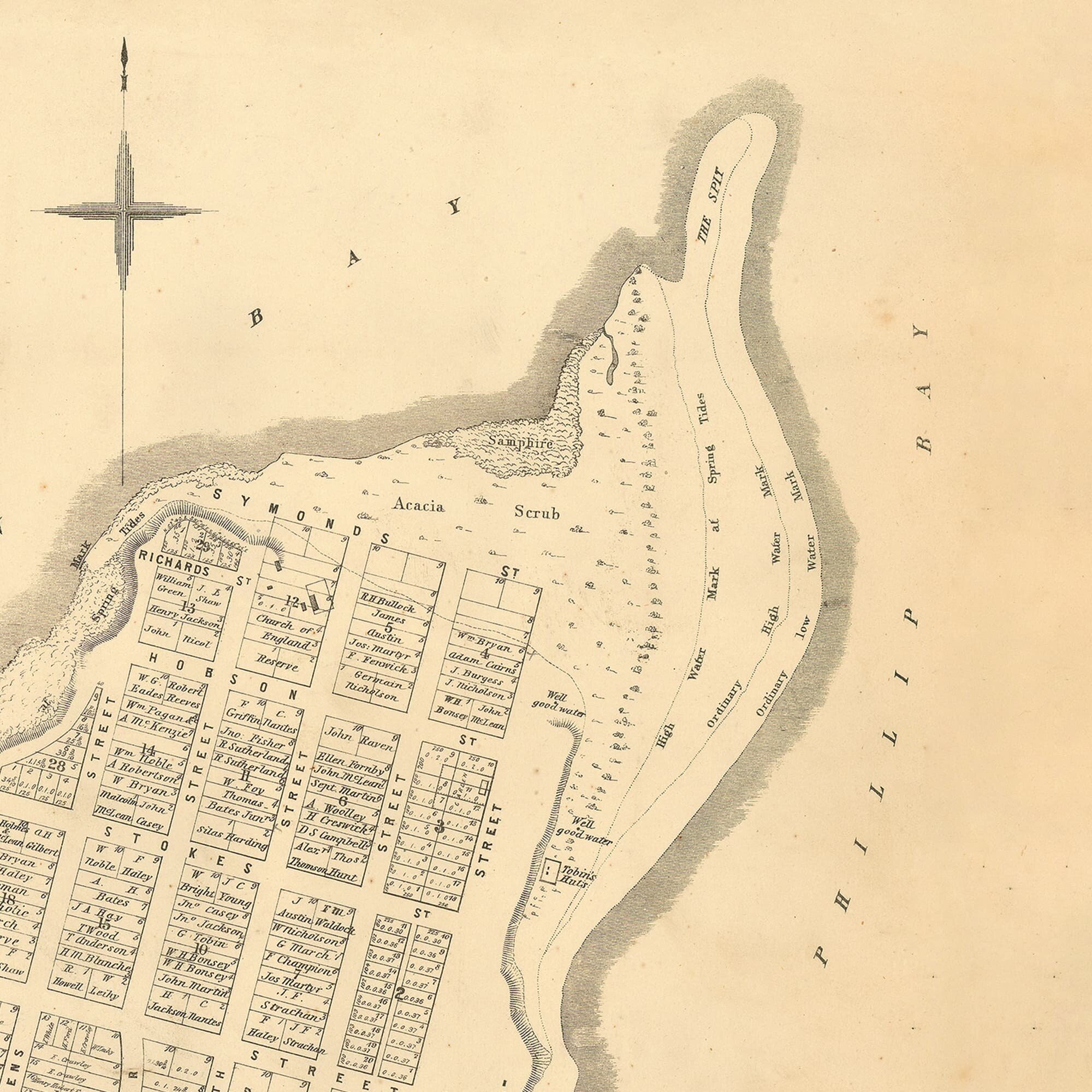

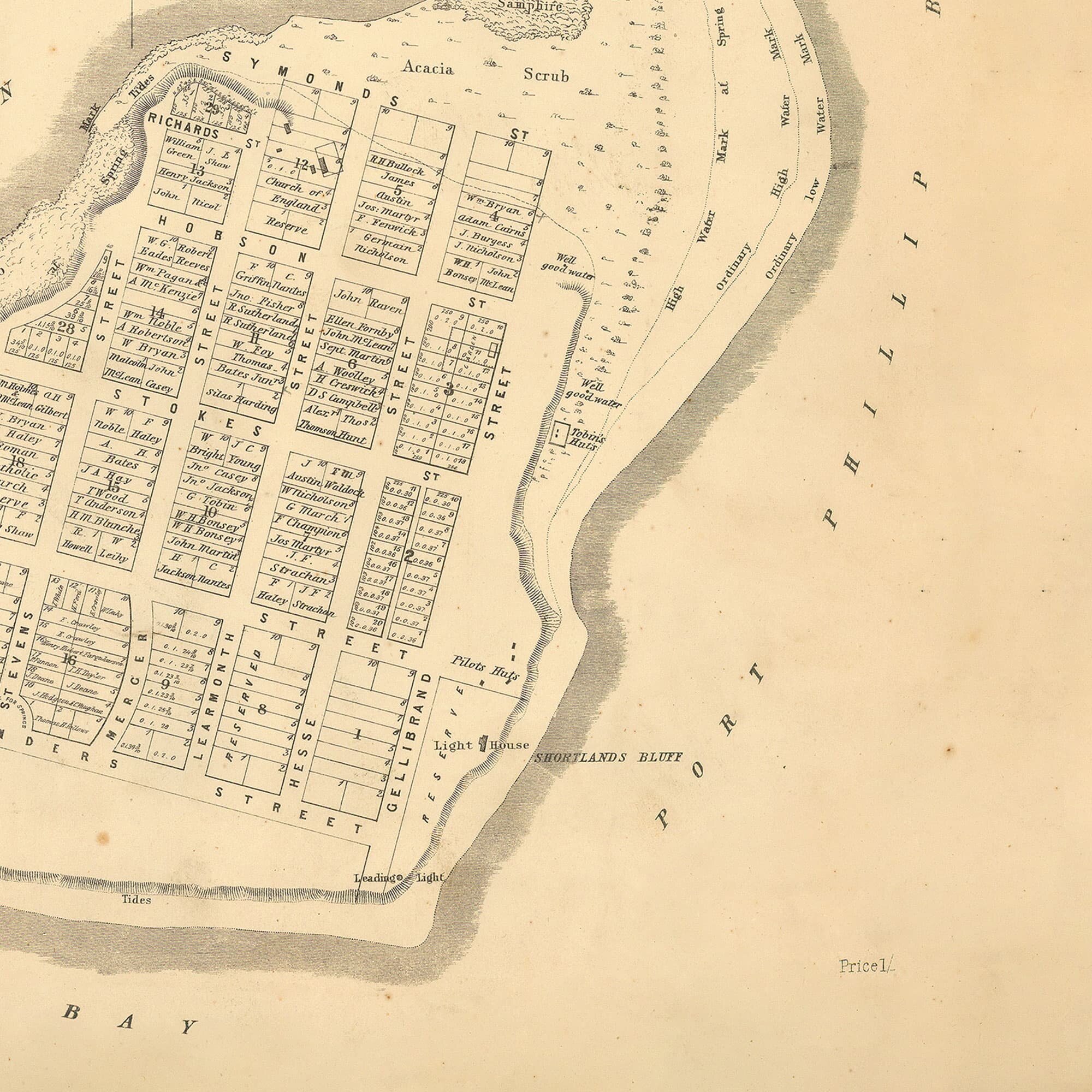
In 1837 surveyors under Robert Hoddle began surveying land in the Port Phillip District for sale to settlers. The Intention was to reserve land for villages and other public or defence purposes. In 1843 a survey near Swan Bay reserved the area for a village where Queenscliff now stands. Ten years later, in 1853, this underlying survey map, laid out the streets and allotments for sale under the name Queenscliff. In 1856, the 1853 map was redone with title owners' names for the Surveyor Generals Office. There would be some familiar family names that are still there today.
In 1837 surveyors under Robert Hoddle began surveying land in the Port Phillip District for sale to settlers. The Intention was to reserve land for villages and other public or defence purposes. In 1843 a survey near Swan Bay reserved the area for a village where Queenscliff now stands. Ten years later, in 1853, this underlying survey map, laid out the streets and allotments for sale under the name Queenscliff. In 1856, the 1853 map was redone with title owners' names for the Surveyor Generals Office. There would be some familiar family names that are still there today.
In 1837 surveyors under Robert Hoddle began surveying land in the Port Phillip District for sale to settlers. The Intention was to reserve land for villages and other public or defence purposes. In 1843 a survey near Swan Bay reserved the area for a village where Queenscliff now stands. Ten years later, in 1853, this underlying survey map, laid out the streets and allotments for sale under the name Queenscliff. In 1856, the 1853 map was redone with title owners' names for the Surveyor Generals Office. There would be some familiar family names that are still there today.