


Footscray Station Township 1870 Framed Print
A1 sized print professionally framed with glass in either Satin Black or Raw Oak
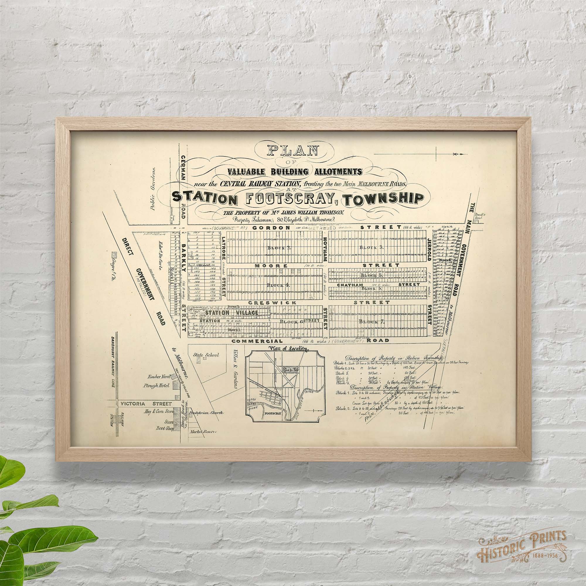
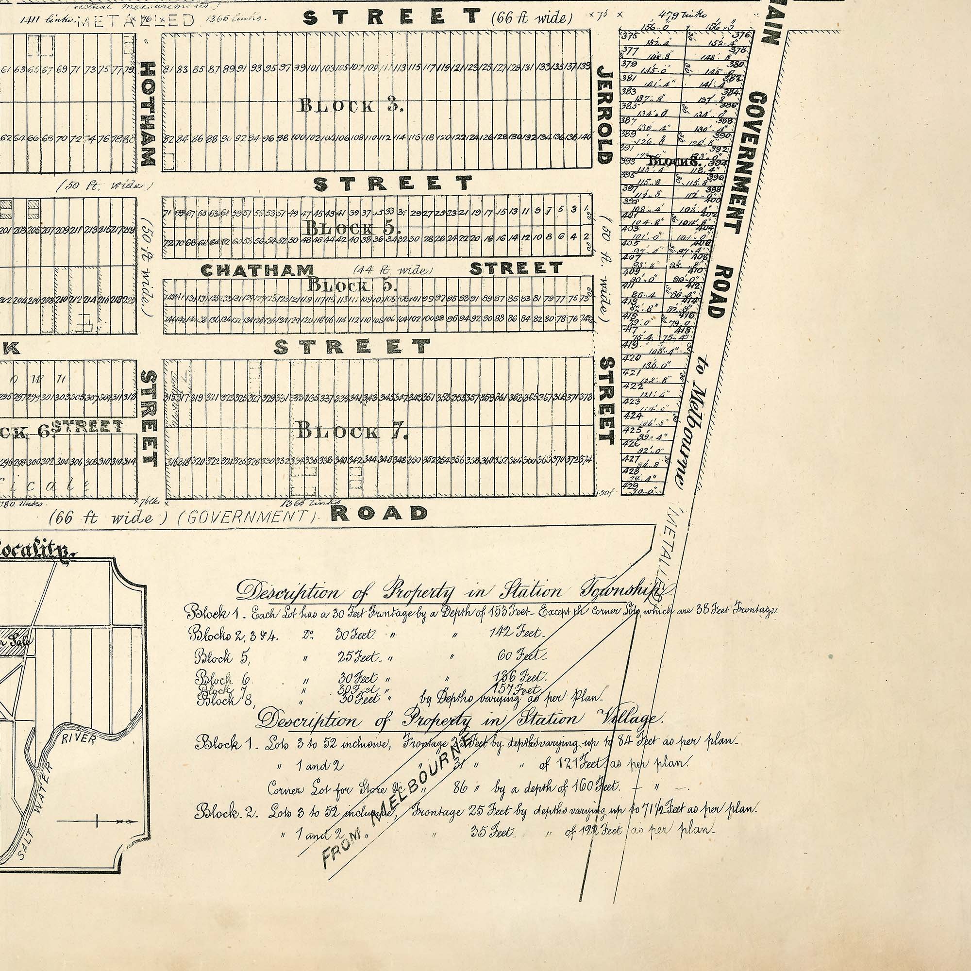
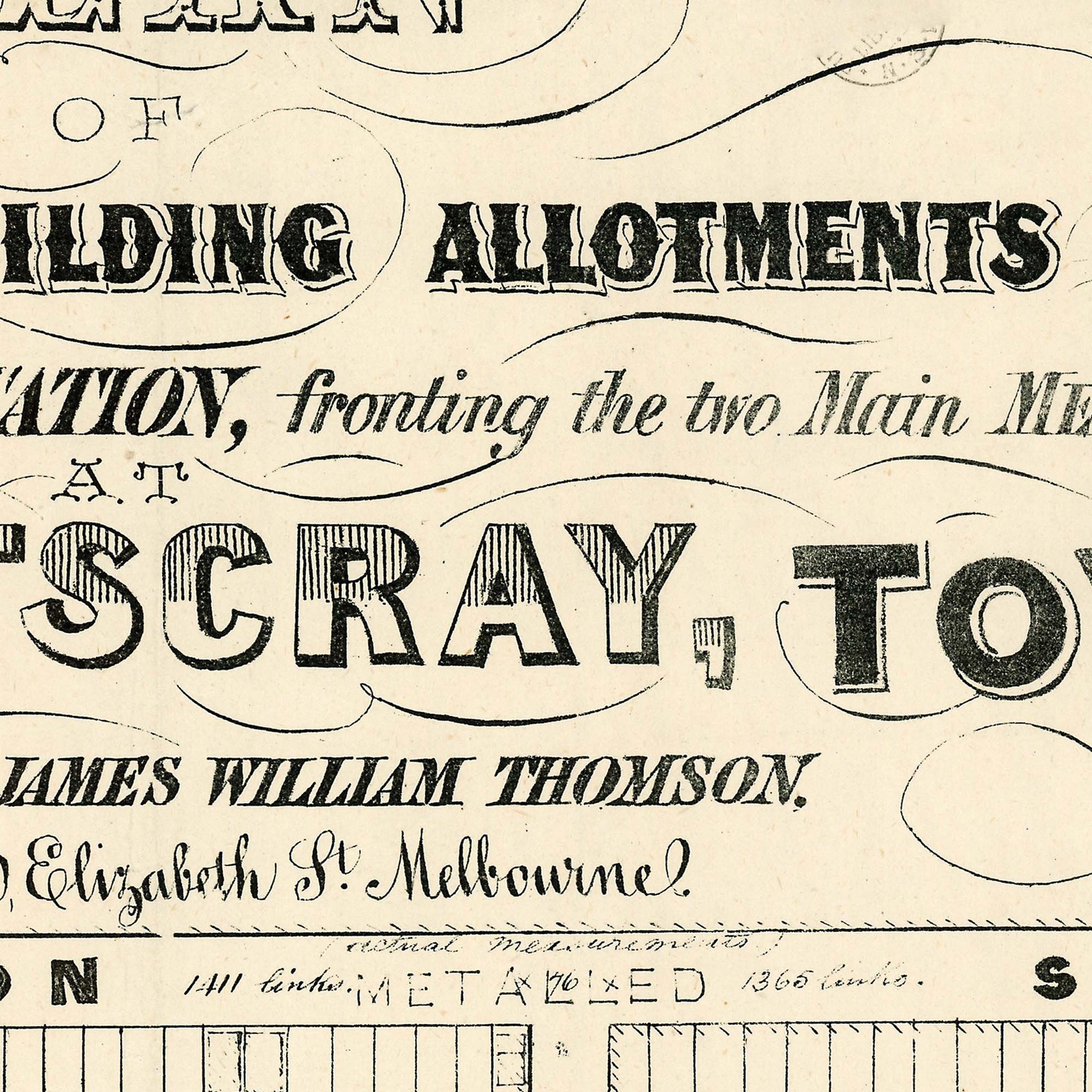
A plan of valuable building allotments near the central railway station (Middle Footscray), fronting the two main Melbourne roads at Footscray during the building boom of the 1870s.
Shows named streets and roads; numbered and measured allotments; Congregational Church, Presbyterian Church, timber yard, "Plough Hotel", "Powell's Hotel", hay & corn store, store, boot shop, market reserve, public gardens, state school, villas and gardens; and Sandhurst Railway line and station.
Features Gordon St, Moore St (Now Macpherson St), Creswick St, Station St (Now Wolverhampton St), Commercial Rd, Chatham St, Barkly St, Hotham St (Now Shepherd St), Jerrold St, Ballarat Rd and Princes Hwy.
A1 sized print professionally framed with glass in either Satin Black or Raw Oak
A plan of valuable building allotments near the central railway station (Middle Footscray), fronting the two main Melbourne roads at Footscray during the building boom of the 1870s.
Shows named streets and roads; numbered and measured allotments; Congregational Church, Presbyterian Church, timber yard, "Plough Hotel", "Powell's Hotel", hay & corn store, store, boot shop, market reserve, public gardens, state school, villas and gardens; and Sandhurst Railway line and station.
Features Gordon St, Moore St (Now Macpherson St), Creswick St, Station St (Now Wolverhampton St), Commercial Rd, Chatham St, Barkly St, Hotham St (Now Shepherd St), Jerrold St, Ballarat Rd and Princes Hwy.