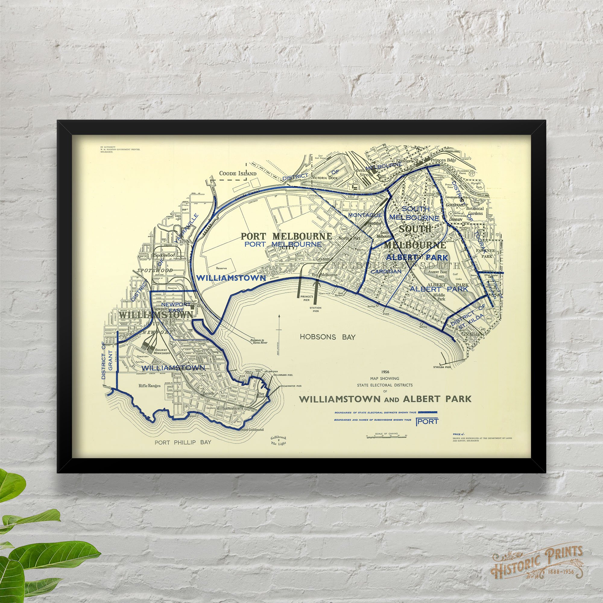


1956 map showing state electoral districts of Williamstown and Albert Park
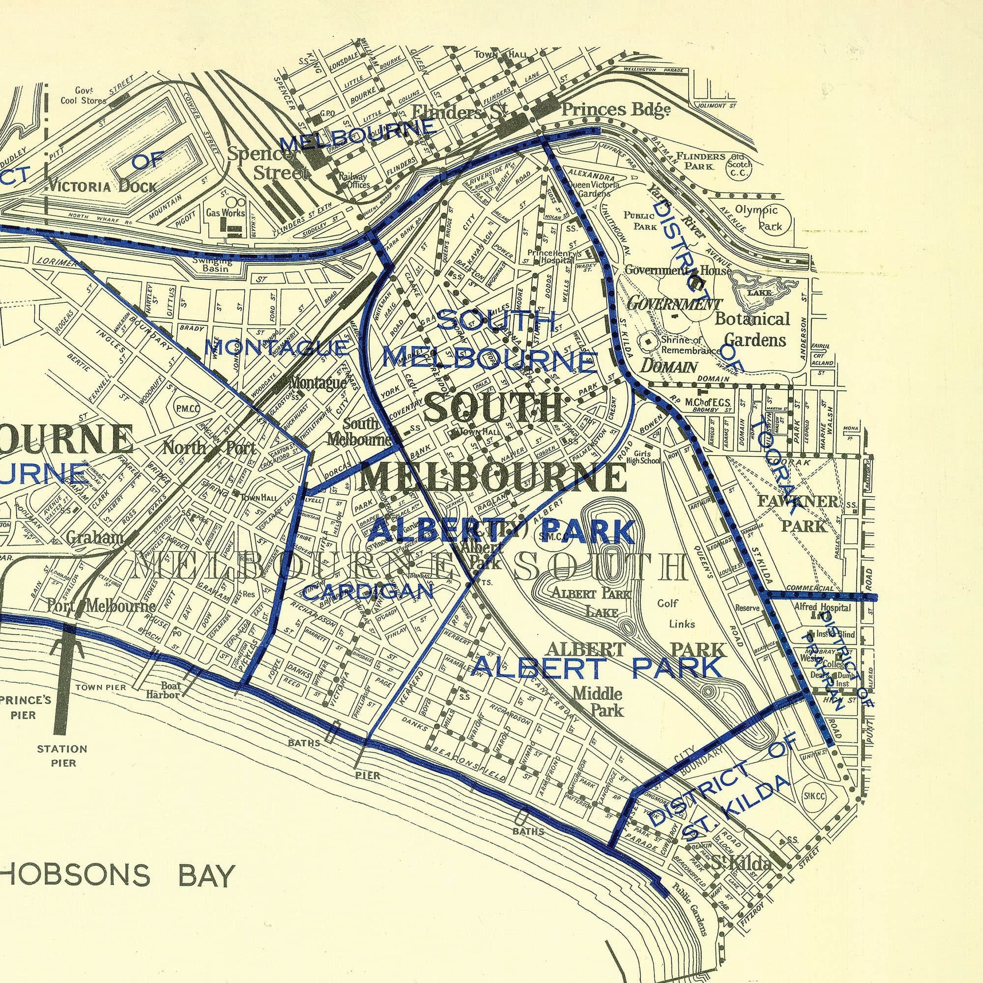
The electoral maps are very popular. Perfect for those wanting a modern yet historic feel of their suburb to match their decor. The biggest bonus of these maps is that the actually contain most modern streets. The early maps of the late 1800s are wonderful, but if your street was established after 1900, you’d miss out on that important visual. The map shows Williamstown, Port Melbourne, South Melbourne and Albert Park.
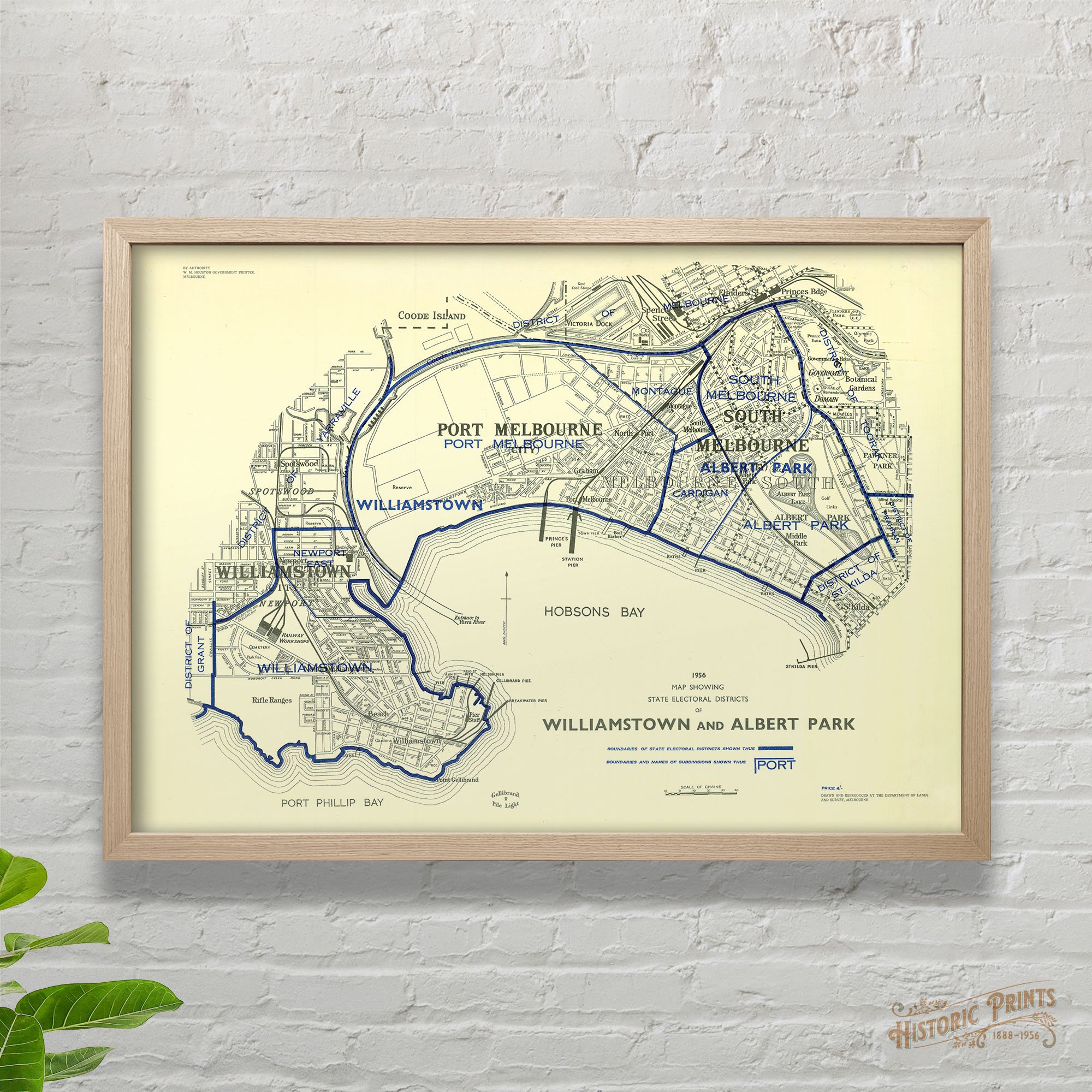
The electoral maps are very popular. Perfect for those wanting a modern yet historic feel of their suburb to match their decor. The biggest bonus of these maps is that the actually contain most modern streets. The early maps of the late 1800s are wonderful, but if your street was established after 1900, you’d miss out on that important visual. The map shows Williamstown, Port Melbourne, South Melbourne and Albert Park.
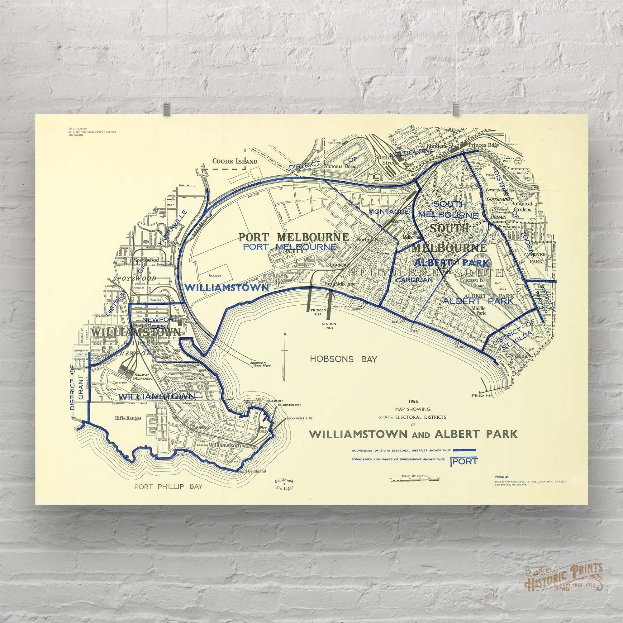
The electoral maps are very popular. Perfect for those wanting a modern yet historic feel of their suburb to match their decor. The biggest bonus of these maps is that the actually contain most modern streets. The early maps of the late 1800s are wonderful, but if your street was established after 1900, you’d miss out on that important visual. The map shows Williamstown, Port Melbourne, South Melbourne and Albert Park.