Smith Street Fitzroy Unrestored
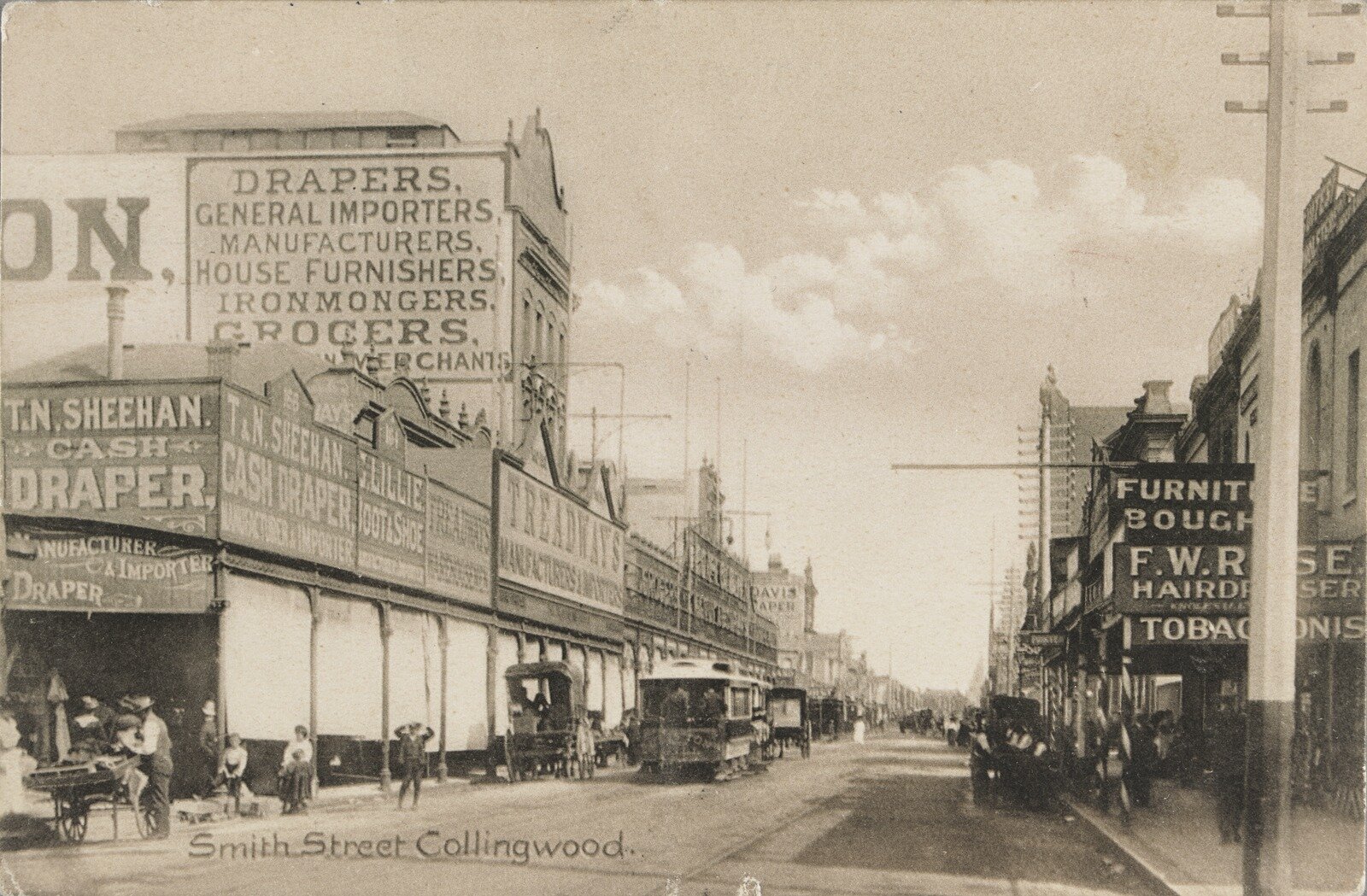
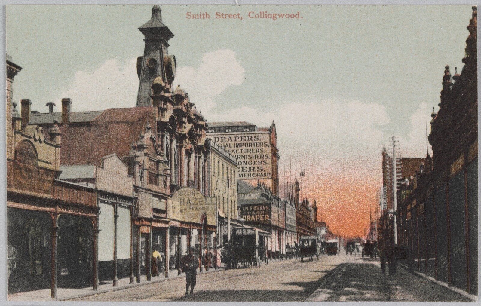
All these feature the Smith Street, Alexandra Parade end, location of Fitzroy. Historically there is a few naming differences to reference. Alexandra Parade was previously called Reilly Parade and the suburb was also known as Collingwood.
Step back in time with our collection of raw historic pieces, each one a potential candidate for digital restoration, printing, and framing. Should you find something captivating for your home, simply place the custom order through our Custom Order Product with our online store. Just copy the title below the desired item, and the listed prices already include the restoration fee. For further inquiries and customisation options, don't hesitate to reach out to us via our Contact form.
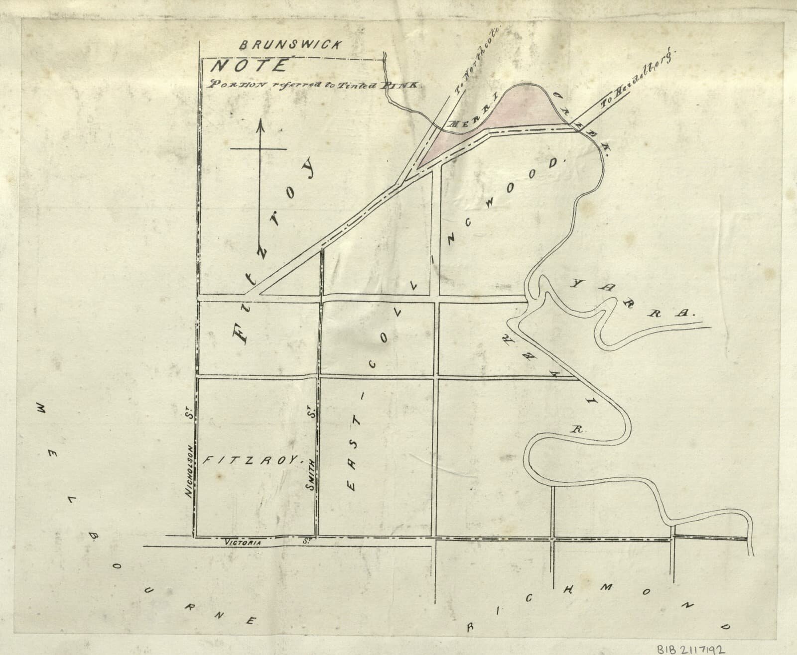
Map of part of Fitzroy and East Collingwood 1800s
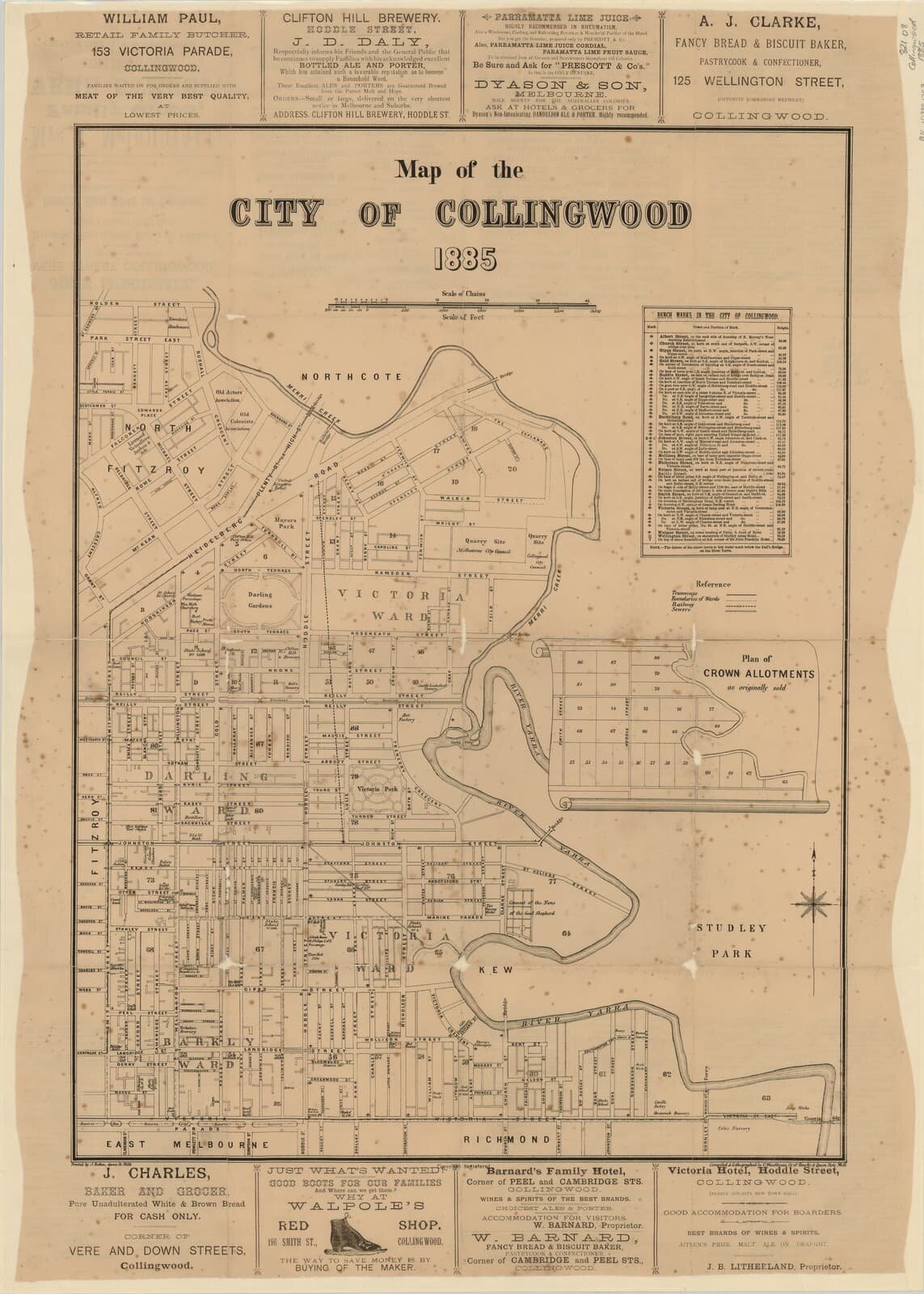
Map of the City of Collingwood 1885

Melbourne and Metropolitan Board of Works detail plan, 1196, City of Collingwood 1900
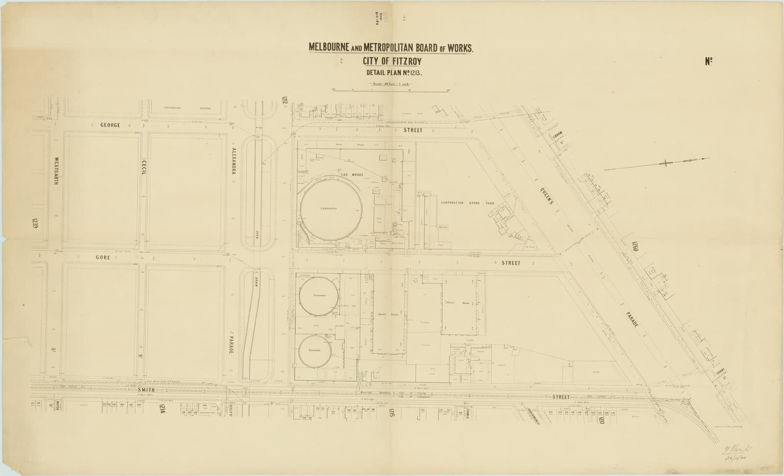
Melbourne and Metropolitan Board of Works detail plan, 1213

Melbourne and Metropolitan Board of Works detail plan, 1214, City of Collingwood 1900
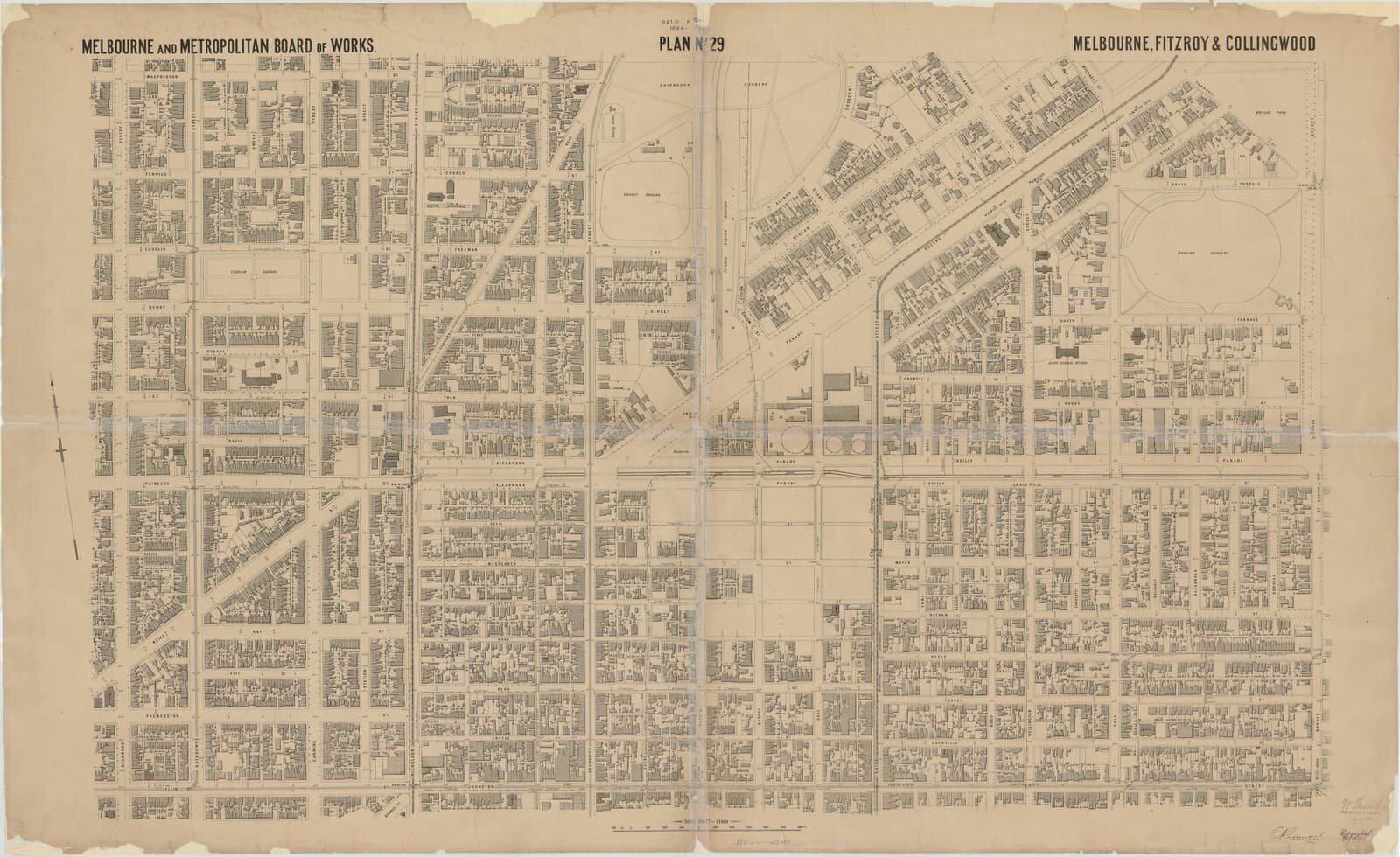
Melbourne and Metropolitan Board of Works. 1896
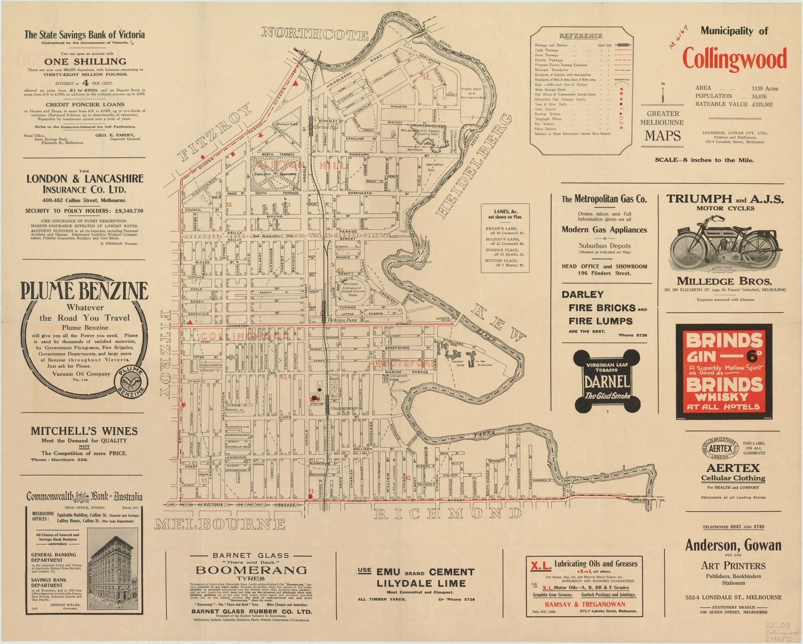
Municipality of Collingwood 1921

1956 map showing state electoral districts of Brunswick East and Fitzroy
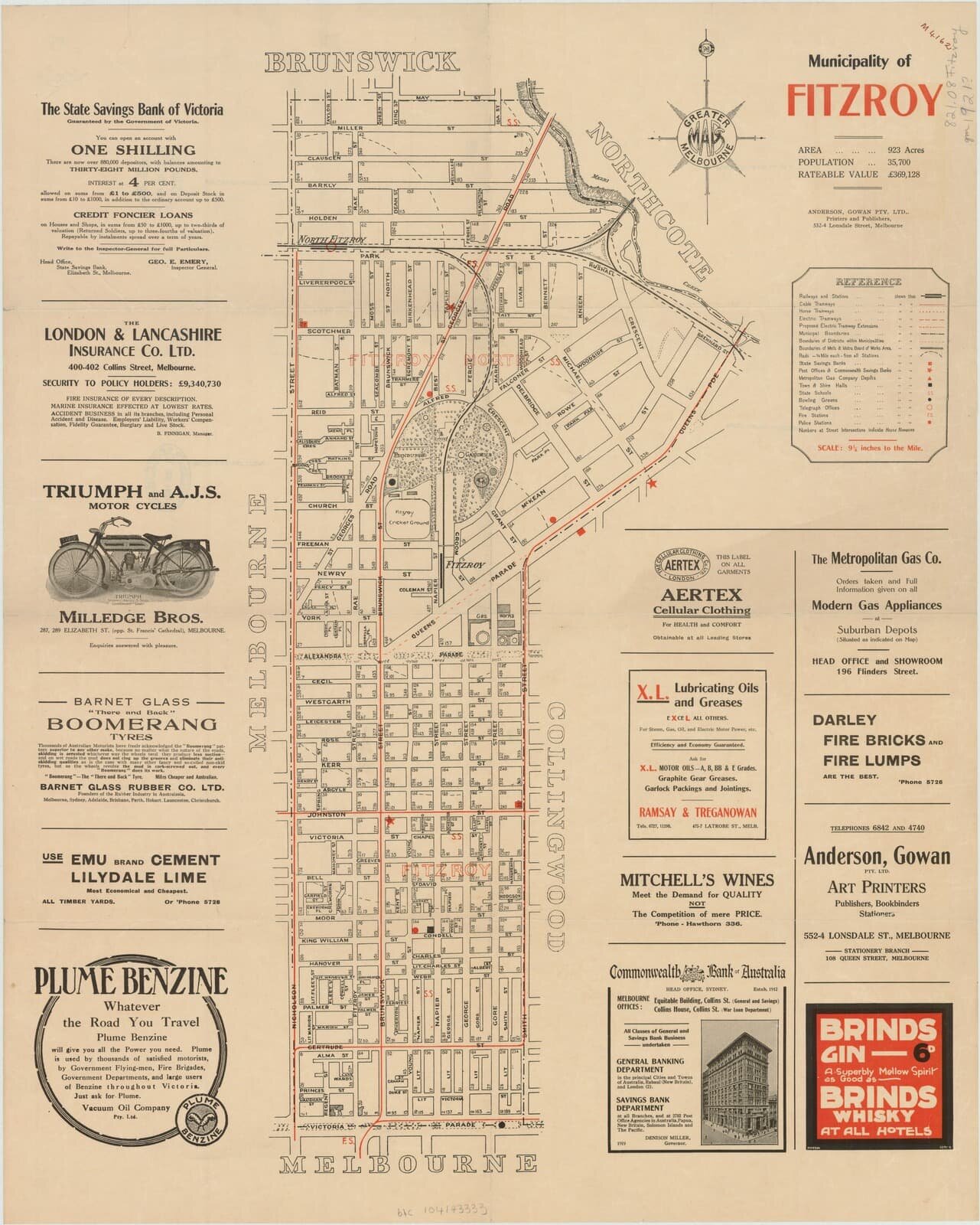
Municipality of Fitzroy 1921

Plan of parts of Collingwood and Richmond Cadastral map showing land allotments, reserves, important buildings, and street names.

Plan of subdivision of suburban allotments Nos. 80 & 81 at Collingwood 1850

Plan shewing the streets and buildings in existence in East Collingwood on January 1st 1858 with schedule of heights of bench-marks above low water datum at Queen's wharf 1818-1893

East Collingwood, Clifton Hill, Section 16, allotments 1 to 17 1880. It's not exactly the location, just below. But Sackville is inherently a amusing street name so I've included.

Clifton Hill and surrounds from Studley Park 1882 A view across Abbotsford looking north-west, from Studley Park. The artist has placed a grazing cow in the right foreground, and a fallen tree in the left foreground, providing a contrast between the pastoral area of the park and the crowded suburbs in the distance. The artist depicts a view to the north-west from a point above the Convent of the Good Shepherd, now the site of the Collingwood Children's Farm. The Johnston Street bridge is visible in the centre of the picture. Beyond are the factories of the inner northern suburbs where many noxious trades such as fellmongering, tanning and woolwashing operated. The spires of St John's in Clifton Hill and the newly-completed Ormond College at the University of Melbourne can be seen on the horizon. Between them sits the Metropolitan Gas Company's gasometer at the corner of Smith Street and Alexandra Parade. The prominent shot tower in Alexandra Parade, which was built in 1882, is not visible in this painting. This indicates that the work was painted prior to this time.

Panoramic view of Fitzroy, Melbourne, Victoria 1889

Collection of architectural drawings for 10 shop fronts at 193 to 211 Smith Street Fitzroy 1926

Collection of architectural drawings for 10 shop fronts at 193 to 211 Smith Street Fitzroy 2 1926

Coffee Palace - Now Woolworths - Smith Street, Collingwood

Postcard Smith Street, Collingwood 1906 1

Postcard Smith Street, Collingwood 1906 2
Postcard Smith Street, Collingwood 1906 3
Postcard Smith Street, Collingwood 1906 4